
Routes
SON TRA PENINSULA BY MOTORBIKE: DANANG RIDING GUIDE
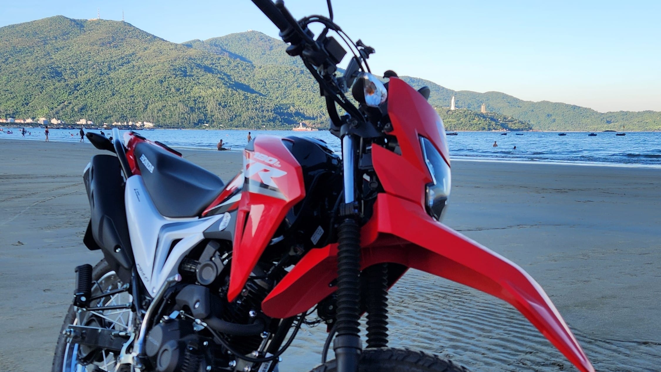
Son Tra Peninsula, often called Monkey Mountain, rises immediately northeast of Danang. From the city centre you can be on the coastal road within minutes, and within a short distance the traffic thins, the forest closes in and views open across the sea and back towards the city. That combination makes Son Tra THE best short motorcycle ride from Danang.
But Son Tra is no longer a place where you should simply follow any road that appears on Google Maps. Checkpoints, vehicle restrictions, one-way sections, landslide closures and military areas affect what can actually be ridden. Some roads that look open on navigation are blocked or are not normal visitor routes, so the route map in this guide focuses on the roads we currently recommend rather than every line shown on Google.
Different motorcycles also open different route choices. Automatic scooters are fine for the easier lower roads, while the controlled upper mountain sections require a semi-automatic or manual motorcycle. This guide explains which route suits which bike, what the roads are actually like, where access currently stops and which parts are better treated as walking extensions.
If you need a suitable motorcycle for the ride, see our Motorbike Rental in Danang page.
WHY SON TRA WORKS SO WELL BY MOTORBIKE
Son Tra is compact enough for a short ride but varied enough to feel like a proper motorcycle outing. In one trip you can move from Danang’s beachfront roads into forest, mountain bends, sea viewpoints and quiet sections where the city feels much farther away than it really is.
That makes it especially useful for riders who do not want to commit an entire day. You can keep the ride easy and stay on the lower roads, spend half a day exploring the mountain on an easy bike, or use Son Tra as a local warm-up before deciding whether you want a longer ride such as Hai Van Pass.
Different Routes for Different Riders
| Route | Difficulty | Type of bike | Condition |
|---|---|---|---|
| Black Route | Easy | Auto, Semi-auto, manual | Smooth lower-road riding; stop where the current checkpoint or barrier requires |
| Blue Route | More challenging | Semi-auto, manual | Steeper mountain riding; Ban Co to Bai Bac is one-way downhill |
| Pink Route | Challenging, ONE WAY | Semi-auto, manual | Steep downhill, ONE WAY ONLY |
| Red Route | Remote, CLOSED | Semi-auto, manual | Tien Sa – Suoi Om – Ban Co corridor under repair from landslide |
Our route map separates Son Tra into three very different riding experiences. The black route is the easiest, with smooth paved roads and gentle gradients. The blue route is the more demanding mountain option, with steeper climbs and descents, narrower sections and loose gravel in places. Note: the pink one-way section. The red route is the smallest and most remote, but it is currently closed and should not form part of a normal visitor ride.
This difference matters more than the total distance. A short, steep descent with loose gravel can demand more concentration than a much longer section of lower coastal road. Choosing the route to match your motorcycle and riding experience is more useful than simply trying to cover the whole peninsula.
Who Is Son Tra Best For?
The easier parts of Son Tra work well for riders who are already comfortable in normal Danang traffic and want a straightforward short or half-day outing. The upper mountain roads are better suited to riders who already understand gear selection, front and rear wheel braking, engine braking and how to control a motorcycle on steeper climbs and descents.
It is not a good place to learn basic motorcycle control for the first time. The mountain sections include checkpoints, blind bends, changing gradients and road surfaces that can alter after heavy rain. If those things already feel familiar, Son Tra is a rewarding ride. If they do not, the lower route still gives you coastline, forest and viewpoints without forcing the more difficult sections.
CURRENT ROUTES, RESTRICTIONS AND RIDING DIRECTION
As of September 2026, Son Tra should be treated as a controlled mountain area rather than an unrestricted road network. The rules are not difficult, but they affect which motorcycle you can use, which roads are open and, in one important case, which direction you may travel. Checkpoint staff can also close a road temporarily when weather or repair work makes conditions unsuitable.
Our black, blue, pink and red route colours are simply a practical way of explaining the riding choices. They are not official route names.
Why Automatic Scooters Are Restricted
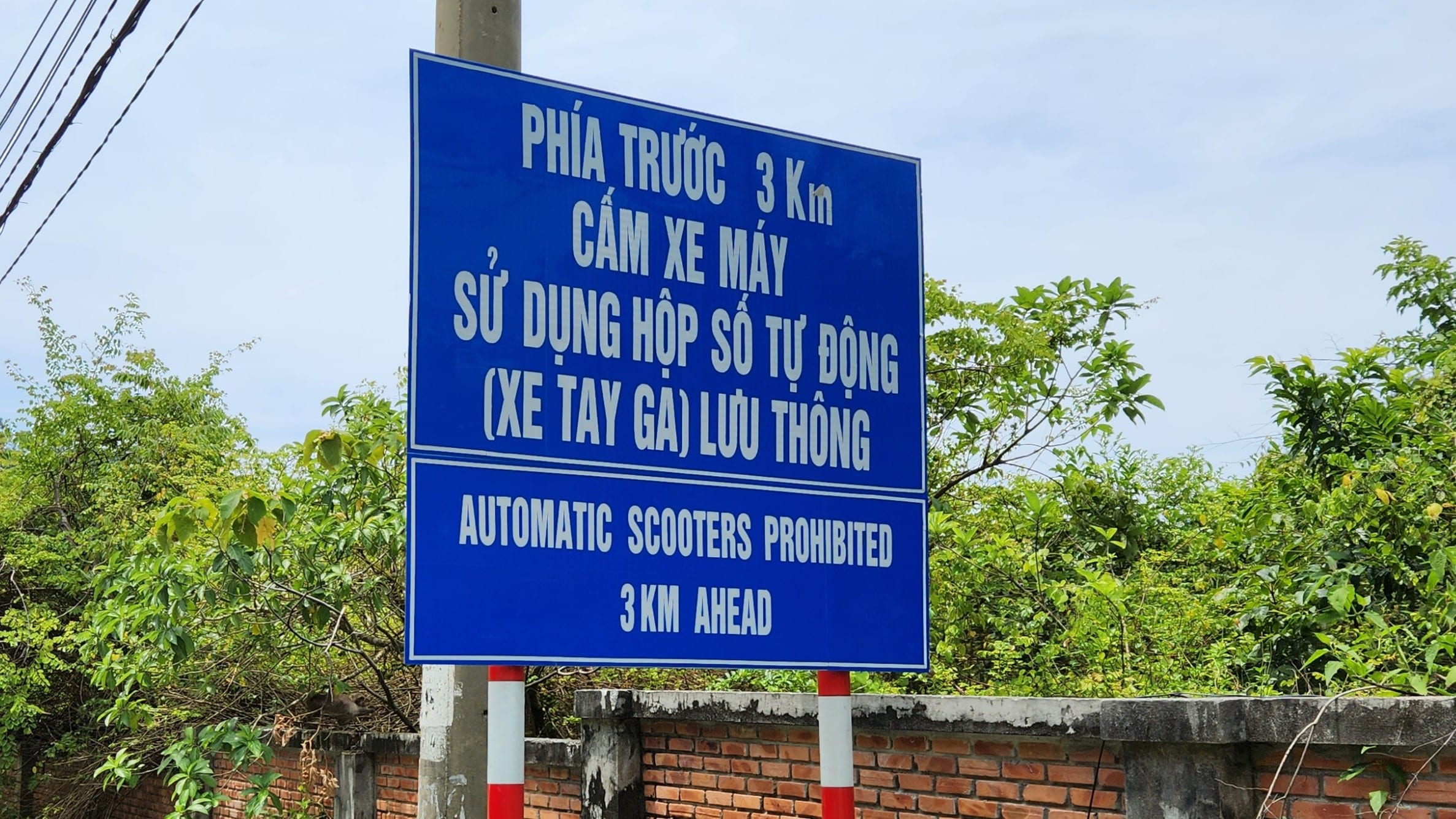
The restriction on automatic scooters did not appear without reason. In 2019, Son Tra saw a serious run of motorcycle crashes; management figures reported 12 accidents in the first seven months of the year, with four deaths and three injuries. Officials said most of the incidents were self-caused and were linked to riders who were unfamiliar with the steep mountain roads or did not have the skills to control the motorcycle properly. Scooter crashes were a particular concern, and the city subsequently banned automatic scooters from the controlled upper mountain roads.
The official accident reports describe loss of control and weak riding technique rather than every individual riding error. From a rider’s point of view, however, the common failure points on these roads are easy to understand: arriving at loose gravel too fast and grabbing too much front brake, losing balance or momentum on a steep incline, running wide on a downhill bend, or holding the brakes for too long on a descent until they overheat and begin to fade. A semi-automatic or manual motorcycle gives the rider the extra control of selecting a low gear and using engine braking rather than relying on the brakes alone.
Blue Route – The Mountain Route
The blue route is the stronger option for an experienced rider who wants more of the mountain itself. The road climbs more steeply, contains tighter bends and has loose gravel in places. A semi-automatic or manual motorcycle is required on the controlled upper sections and also gives you the advantage of choosing a lower gear for climbs and descents.
The whole blue route is not one-way. The key one-way restriction (pink section) begins after Ban Co Peak. From Ban Co, traffic is permitted downhill towards Bai Bac and the junction near the InterContinental. Riders should not plan to approach from the InterContinental side and ride this section uphill in reverse.
Ban Co to Bai Bac – One Way Downhill
This is the section of the blue route that deserves the clearest explanation. Once you leave Ban Co towards Bai Bac, you are committing to a one-way descent. The road is narrower and steeper than the easy lower route, and gravel can collect on the surface, particularly after rain or minor slips from the hillside. It is also quite remote.
Use a low gear and let the engine control part of your speed. Brake smoothly and try to do harder braking while the motorcycle is upright rather than leaned over on a loose patch. The road eventually brings you out near the Bai Bac / InterContinental side of the peninsula, but it should not be treated as a two-way shortcut back to Ban Co.
Monkey Pass from the InterContinental Side
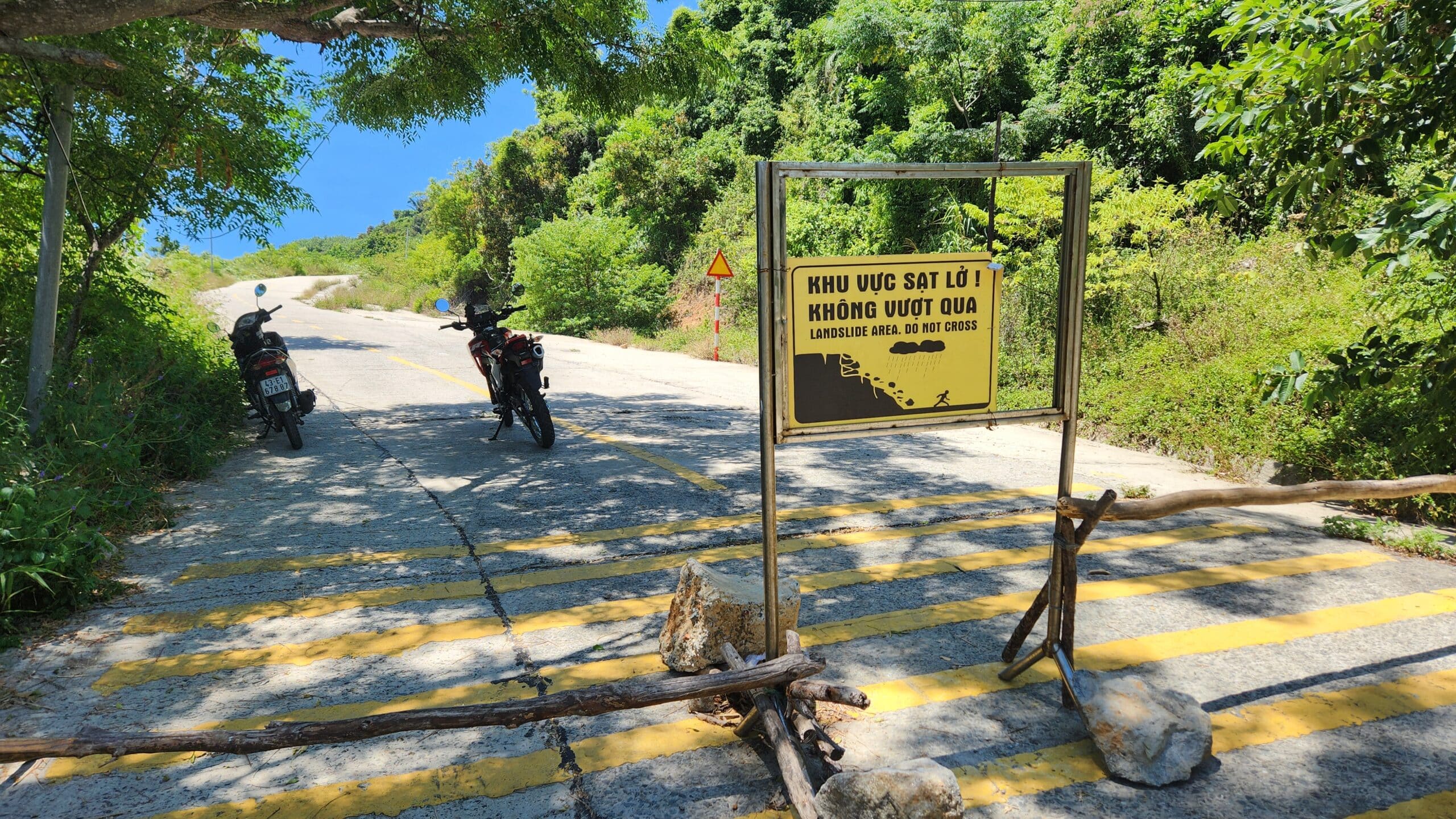
Riders sometimes see the road near the InterContinental and assume they can simply ride uphill towards Ban Co. Do not plan the route that way. The official flow on the controlled section is from Ban Co down towards Bai Bac, not the reverse, and the lower end has been physically blocked at times.
That matches what we have found on the ground: a road can be visible, paved and physically present without being a route visitors are currently allowed to use in both directions.
Red Route – Currently Closed
The red route is the smallest, wildest and most remote road on our map. When open, much of it is concrete-paved, not especially steep and generally in reasonable condition, but it feels considerably more isolated than the black or blue routes.
At the moment, however, this route should be treated as closed. The Tien Sa – Suoi Om – Ban Co corridor is temporarily suspended while storm and landslide damage is repaired, and there is a checkpoint near the military area. The road from the helicopter-pad side towards Suoi Om may look physically rideable in places, but that does not make the corridor an authorised visitor route while the closure remains in force.
Do not enter from the opposite end simply because nobody appears to be standing there.
Walking-Only and Restricted Areas
The Bai Bac junction to the Heritage Banyan Tree is walking only. That means the motorcycle part of that visit ends before the tree. Park where instructed and treat the walk as part of the outing.
Caution: Some roads and trails around Son Tra have also become popular online despite not being normal authorised visitor areas. Current Danang guidance specifically warns against self-guided access to Mui Nghe, Bai Da Den and Huc Lo / Ghenh Bang. Old blog posts and map pins are not enough reason to ignore a barrier or warning sign.
Opening Hours and Weather Closures
Current visiting hours are 07:30–18:30 from March through September and 07:30–17:30 from October through February. These hours do not guarantee that every route will be open throughout the day. Heavy rain, strong wind, landslides or repair work can lead to temporary closures.
For a motorcycle rider, the practical approach is simple: start early, check the weather and accept the information given at the checkpoints. Son Tra is close enough to Danang that changing the plan is easy if the upper mountain is closed.
BEST STOPS ON SON TRA
Son Tra has plenty of named sights, but the best stops are the ones that fit naturally with the roads you can actually use. There is little value in building the day around a hidden beach or viewpoint if the access road is closed or the approach is not an authorised visitor route.
Linh Ung Pagoda and Lady Buddha
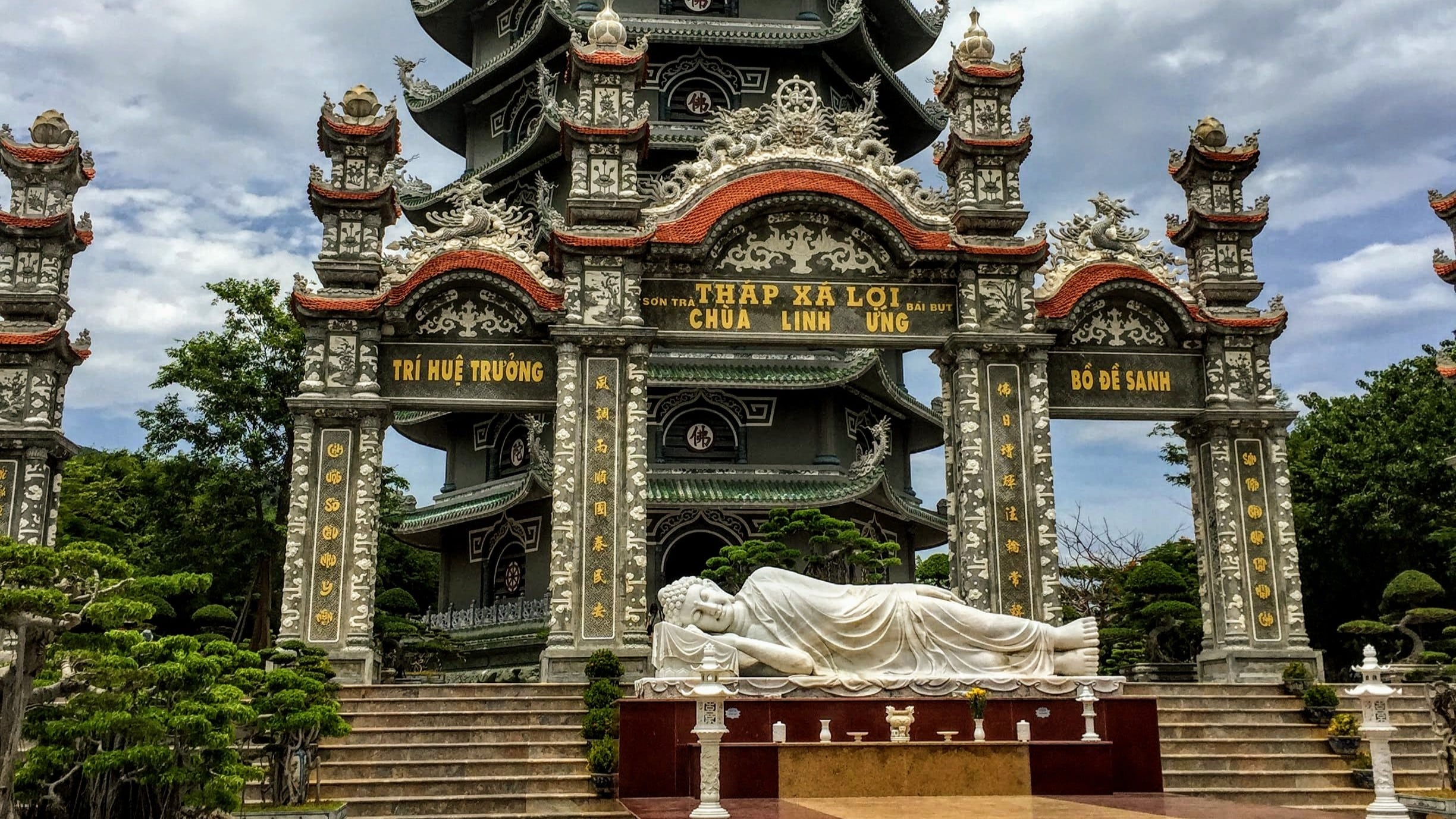
Linh Ung Pagoda is the obvious first stop for many riders approaching from Danang. It sits above the coast with wide views back towards the city and is easy to reach on the lower road. The large Lady Buddha statue is visible from much of Danang’s seafront, so reaching the pagoda gives some context to a landmark you have probably already seen from the city.
This is also a useful decision point. If weather is deteriorating on the upper mountain, you can still enjoy Linh Ung and the lower coast without committing to the blue route.
CHESSBOARD PEAK
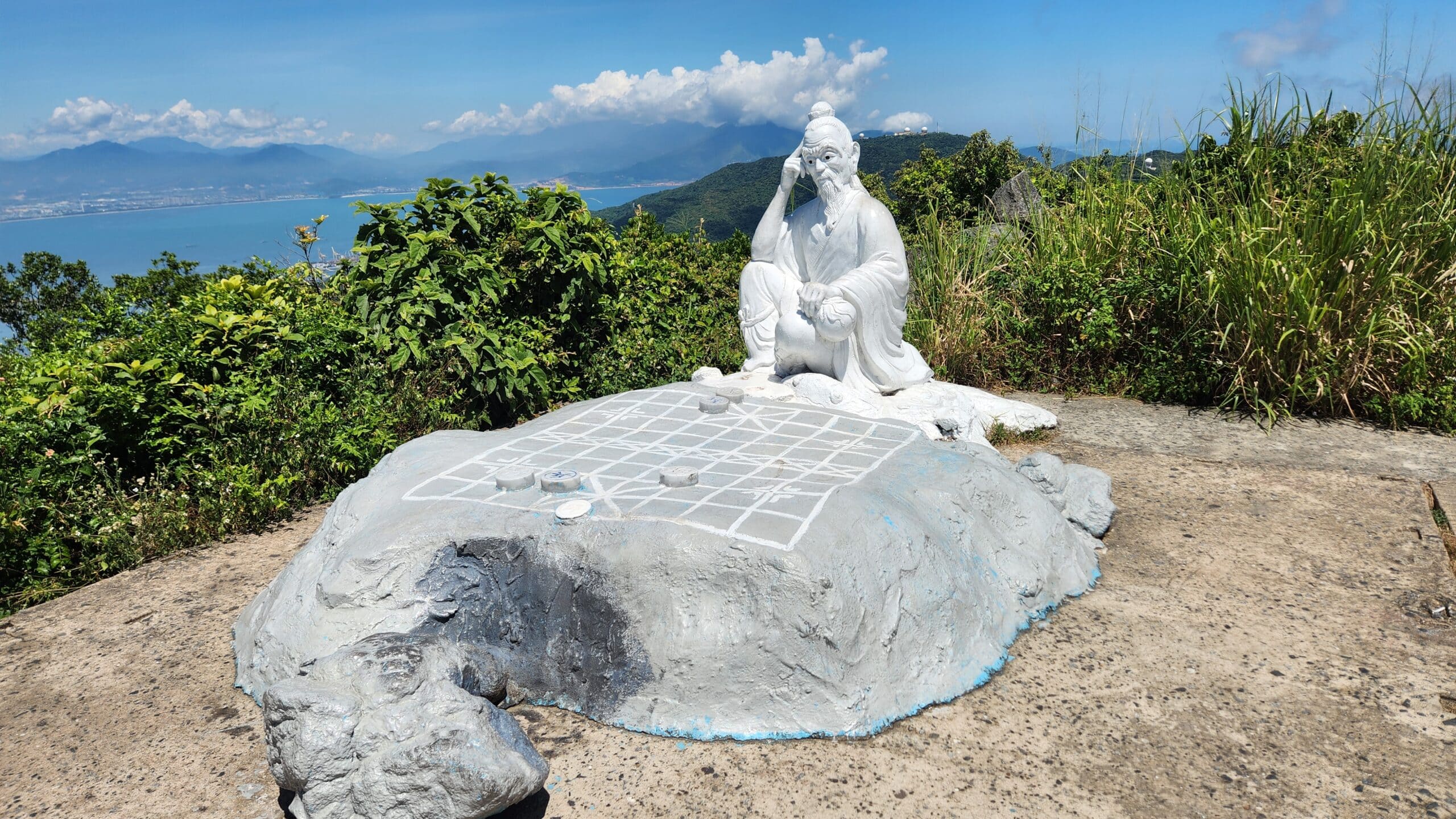
Ban Co, or Chessboard Peak, is one of the best-known high points on Son Tra. The attraction is partly the statue and legend, but for a motorcycle rider the approach is at least as interesting as the summit. The road climbs away from the easier lower sections and gives a much clearer sense of the mountain’s height and terrain.
It can be busy at the top, particularly at popular photo times, so park properly and keep the narrow road clear. Ban Co is also the decision point for the one-way descent towards Bai Bac: once you continue in that direction, you should not expect to reverse the route and ride back uphill from the InterContinental side.
Heritage Banyan Tree
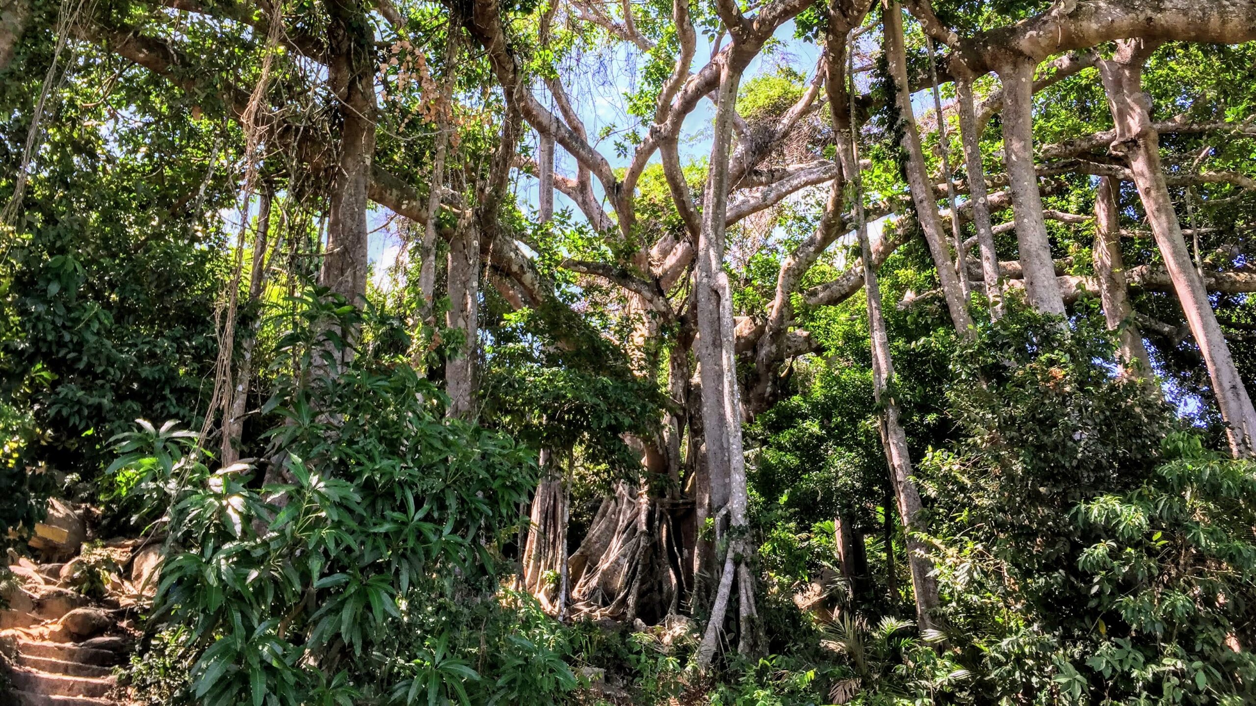
The Heritage Banyan Tree is more than 800 years old and is one of Son Tra’s most distinctive natural sights. Current visitor guidance treats the Bai Bac junction to the tree as a walking route, so it is better thought of as a hike attached to a motorcycle day rather than a motorcycle destination in its own right.
Older route information puts the distance from the Bai Bac junction to the Heritage Banyan Tree at roughly 3.5 km. If you are walking most of that section, allow around 45–60 minutes each way at a normal pace. That means roughly 1.5–2 hours of walking, or closer to 2–2.5 hours if you want time at the tree rather than simply turning around. The exact time will depend on where checkpoint staff require you to park on the day.
Carry enough water for the whole walk because there is very little, and potentially nothing, available once you leave the road. Remember that the return still has to fit within the peninsula’s opening hours.
Tien Sa Lighthouse
Tien Sa Lighthouse is another worthwhile place to know about, particularly if you enjoy the quieter historical corners of Son Tra. It dates from the French colonial period and sits above the eastern side of the peninsula with broad views towards the sea.
Access can vary. In our experience, visitors have sometimes been allowed inside after speaking to the lighthouse keepers and paying a small fee, but this should not be treated as guaranteed. If the walking access is open, ask locally when you arrive rather than relying on an old online review.
Wildlife and Forest Viewpoints
Son Tra is home to the red-shanked douc langur as well as macaques and other wildlife. Seeing a douc in the trees is more memorable than forcing another attraction into an already busy route, but wildlife sightings cannot be scheduled.
If you see animals near the road, slow down without stopping in a dangerous position. Do not feed monkeys and keep food and loose belongings secured when you stop. Son Tra is a protected natural area first and a motorcycle destination second.
MOTORCYCLE, ROAD AND WILDLIFE ADVICE
The most useful riding advice on Son Tra depends on which route you choose. The black route is straightforward; the blue route asks much more of the rider; and the red route should not be part of the plan while it remains closed. Treat those differences seriously rather than judging the whole peninsula by the easy road you encounter first.
Which Motorcycle Is Best?
An automatic scooter is enough if you intend to stay on the easier lower roads and stop before the controlled upper sections. That makes the black route useful for someone who already has a Vision or similar city scooter and simply wants an easy Son Tra outing.
If you want to ride to Chess Board Peak and the blue mountain route, choose a semi-automatic or manual motorcycle. A Honda Wave or Future gives you gears and engine braking without being physically large, while an XR150L or XR190L gives a more upright riding position, more suspension travel and better control on rougher or gravelly sections. You do not need a large adventure motorcycle for Son Tra.
For current bike options, see Motorbike Rental in Danang.
Riding Two-Up With a Pillion
Riding Son Tra with a pillion changes the way the motorcycle accelerates, steers, brakes and reacts on steep gradients. The extra weight increases stopping distance, makes slow-speed manoeuvres harder and puts more load on the suspension and brakes. A climb that feels straightforward solo can also become much more demanding when the motorcycle is carrying two people.
The biggest difference is on the descents. With more weight pushing the motorcycle downhill, you need to plan your speed earlier, use engine braking and avoid relying continuously on the brakes. Brake fade becomes more of a concern, particularly on a long descent if the rider is dragging the brakes rather than using the gears to help control speed.
Loose gravel and mud also deserve more respect when riding two-up. The motorcycle has more momentum and takes longer to change direction or slow down, while a sudden movement from the passenger can unsettle the bike at exactly the wrong moment. The pillion should stay relaxed, move naturally with the motorcycle and avoid sudden shifts of body weight.
For two-up riding, we would be more conservative about route choice. The black route remains an easy option for a competent rider and pillion, but the blue mountain route is better suited to someone who already has experience carrying a passenger on steep roads. If you are not comfortable controlling the motorcycle two-up on inclines, descents and loose surfaces, Son Tra is not the place to learn.
Steep Climbs and Descents
The blue route contains climbs steep enough to expose poor gear choice quickly. Select the gear before the steepest part rather than waiting until the engine is already struggling, and keep enough momentum to avoid an awkward stop on a loose incline.
So often, the same gradient becomes a descent later. Use engine braking and both brakes smoothly instead of relying on one brake for a long downhill section. Be progressive with the front brake on gravel or dirty surfaces and do harder braking before the corner rather than while leaned over whenever possible.
Gravel, Mud, Landslides and Changing Surfaces
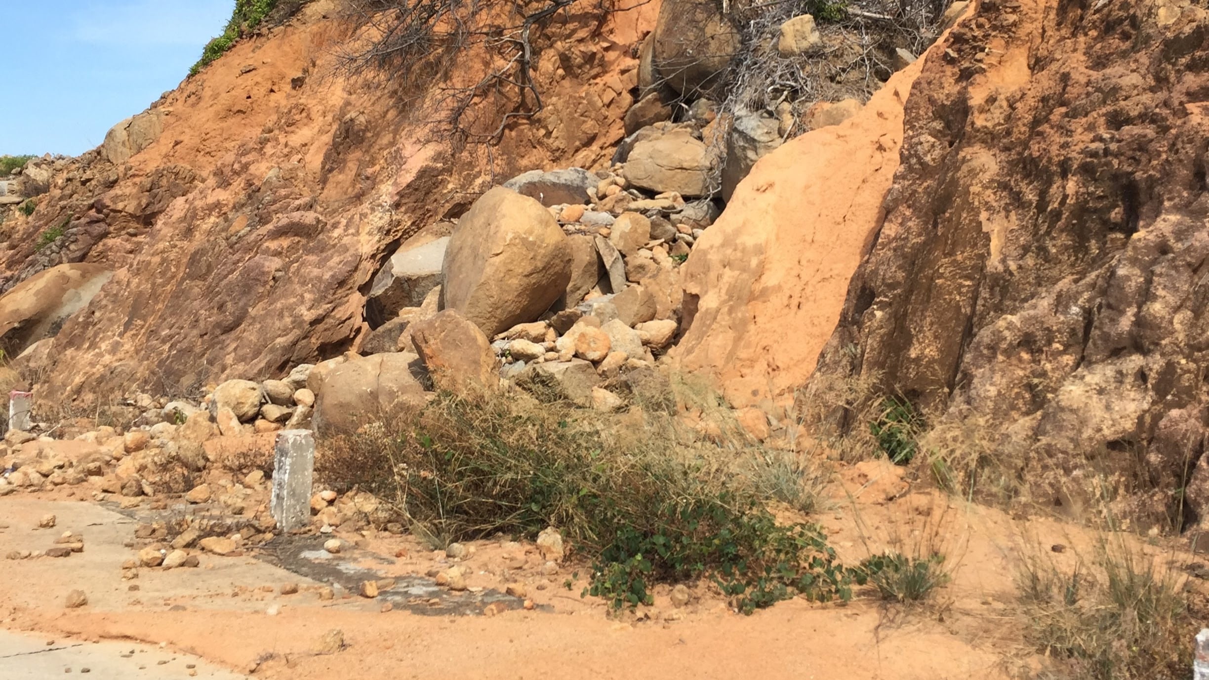
Son Tra receives heavy rain and the roads cut across steep forested slopes. Stones, leaves, mud and washed gravel can appear even when most of the road is dry. The blue route in particular can change quickly from clean tarmac to a loose patch on a climb or corner.
Mud is especially easy to underestimate. The exposed tarmac may dry quite quickly after a shower, while mud in shaded forest sections can stay damp and slick for much longer. That sudden change from a high-grip dry road to a wet muddy patch can catch a rider out very quickly, particularly if it appears on a bend or downhill section. Reduce speed before the surface changes and avoid abrupt braking or steering inputs once you are already on it.
Do not assume yesterday’s condition is today’s condition. Fresh debris, a newly placed barrier or checkpoint instructions are more important than what your navigation app says. This is especially true after several days of rain.
Watching the Weather
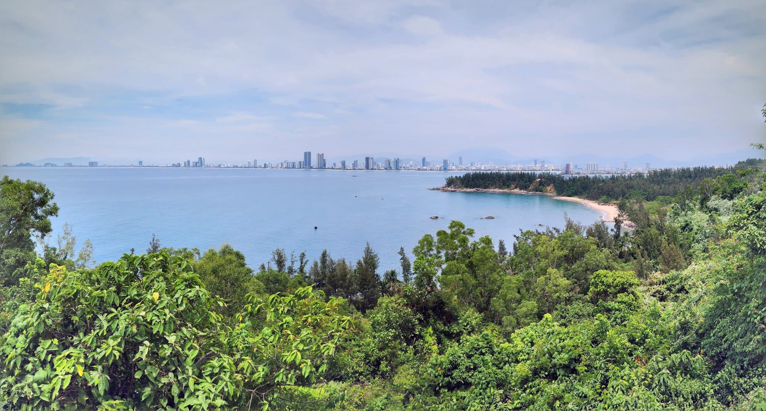
One advantage of riding Son Tra is the huge open view over the sea. On many parts of the mountain you can actually see a rain shower moving across the water before it reaches you. Use that view as an early warning. If you can see a dark wall of rain approaching, decide whether to turn back, drop to the lower roads or get through a more exposed section before the surface becomes wet rather than waiting until the rain is already on top of you.
Fuel, Water and Heat
There is very little reliable fuel once you are on the mountain, so fill up in Danang or near the base before riding. Son Tra is geographically small, but running short of fuel on a steep road in the heat is still an unpleasant way to spend an afternoon.
Carry water as well. The breeze while riding can disguise how hot the day is, and the upper roads have long stretches with nowhere convenient to buy a drink. Cover your arms and neck, use sunscreen on exposed skin and take a proper break rather than trying to complete every route in the hottest part of the day.
Wildlife on the Road
Monkeys are one of the reasons Son Tra is enjoyable, but they also create a distraction. Riders sometimes slow suddenly or stop wherever they happen to see an animal, so pay attention to what the traffic ahead is doing as well as to the trees.
Never chase wildlife down a side road or trail. The red-shanked douc langur is best observed quietly from a distance, and leaving the authorised route for a photograph is not worth the risk to you or the animals.
PLANNING YOUR SON TRA RIDE FROM DANANG
The best Son Tra ride is not necessarily the one that covers the greatest distance. Choose the route according to your motorcycle, your skills, the current access status and how much time you actually want to spend off the bike at viewpoints or walking sections.
Easy Ride on an Automatic Scooter
If you are on an automatic scooter, keep the day simple. Ride the lower coastal roads, stop at Linh Ung Pagoda and follow the easy black route only as far as current signs and checkpoint staff allow. This gives you sea views, forest and a genuine change from central Danang without forcing a scooter onto roads where it is not permitted.
Allow a few hours rather than trying to race around the peninsula. There are enough stops along the lower road that the easy version still feels like a worthwhile ride.
Half-Day Mountain Ride on a Semi-Auto or Manual
For a more experienced rider, the blue route is the stronger half-day option. Approach Ban Co from the permitted side, allow time at the summit, then continue only if the checkpoint is open and you are comfortable with the one-way descent towards Bai Bac.
Once you commit to Ban Co → Bai Bac, think of it as a through route rather than an out-and-back. The road is steeper and more demanding than the black route, so leave enough daylight and avoid beginning the descent just before closing time or when heavy rain is approaching.
If you are riding with a pillion, treat the blue route as a significant step up in difficulty. The extra weight affects braking, low-speed control and steep downhill sections, so only choose it if you already have two-up mountain-riding experience.
Add the Walking Section Only If You Have Time
The Heritage Banyan Tree is worth adding if you enjoy walking as well as riding, but it changes the timing of the day. Depending on where you are required to park, the return walk can take around 1.5–2 hours before you add time at the tree itself, so do not leave it until late in the afternoon.
The lighthouse may also be possible as an extension when local access allows. Treat this as a bonus rather than something around which the whole ride depends.
Do Not Plan Around the Red Route While It Is Closed
The red route may become one of the most interesting roads on Son Tra again when repairs are complete. It is remote, narrow and much less developed than the main visitor roads, which is exactly why experienced riders may find it appealing.
For now, leave it off the riding plan. We will update this guide and route map when access officially changes rather than suggesting that visitors enter from an unguarded end or work around a barrier.
Make Son Tra Part of a Danang Riding Plan
Son Tra works well as a first local ride after arriving in Danang because it lets you get used to the motorcycle without immediately committing to a long-distance day. If you enjoy the mountain roads and want a longer ride next, Hai Van Pass by Motorbike is the natural progression.
For riders planning several days around Central Vietnam, use our Vietnam motorcycle route maps to compare the next route rather than relying only on the fastest navigation option. A good Danang trip can move from an easy local Son Tra ride to Hai Van and then into longer Central Vietnam routes without repeating the same kind of riding.
FAQ
Can I ride an automatic scooter on Son Tra Peninsula?
Yes, but not on every route. Automatic scooters are suitable for the normal lower coastal roads. They are not permitted on the controlled upper mountain routes towards Ban Co and Bai Bac, so stop when you reach a checkpoint or restriction applying to your motorcycle.
Which part of Son Tra is one-way?
The one-way restriction applies to the section from Ban Co Peak downhill towards the Bai Bac junction near the InterContinental. The permitted direction is Ban Co → Bai Bac. Do not plan to ride the same mountain section uphill from the InterContinental side.
Is the red route on the map open?
No. As of September 2026, the Tien Sa – Suoi Om – Ban Co corridor is temporarily suspended while storm and landslide damage is repaired. Treat the red route as closed even if one end appears physically accessible.
Can I ride to the Heritage Banyan Tree?
Current guidance lists the Bai Bac junction to the Heritage Banyan Tree as walking only. Park where instructed and continue on foot. Access arrangements can change, so follow the signs and checkpoint staff on the day.
What is the best motorcycle for Son Tra?
For the lower roads, a normal automatic scooter is enough. For Ban Co and the blue mountain route, use a semi-automatic or manual motorcycle so that you meet the access rules and can use the gears for steep climbs and engine braking on descents.
CHOOSING THE RIGHT SON TRA RIDE
Son Tra is one of the easiest places to turn a few free hours in Danang into a proper motorcycle outing, but the peninsula rewards riders who understand that not every road is open and not every motorcycle is suitable for every section.
Keep the route simple on an automatic scooter, or use a semi-auto or manual bike if you want the steeper blue mountain route through Ban Co. Respect the one-way Ban Co → Bai Bac section, leave the red route alone while it is closed and treat the Heritage Banyan Tree as a walking extension rather than a road destination.
The result is still a very good ride: coastal roads, forest, high viewpoints, wildlife and enough variation to feel completely different from Danang city. If you need the right motorcycle, start with Motorbike Rental in Danang. If Son Tra leaves you wanting a longer mountain day, continue with Hai Van Pass by Motorbike.