Routes
Quan Ba to Yen Minh: Misty Mountain Hop
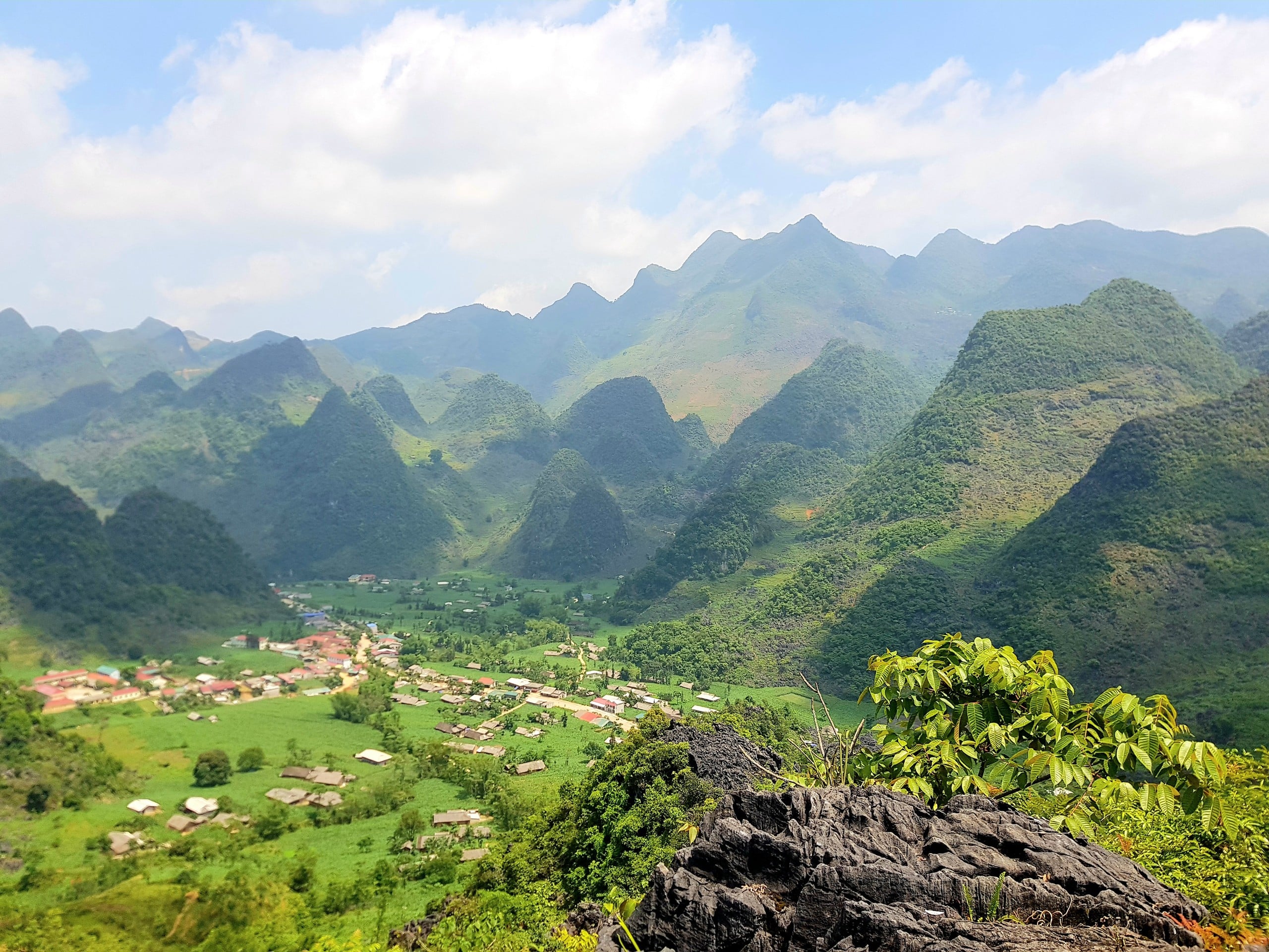
Passing the Fairy Mountains, the ride from Quan Ba to Yen Minh marks another step UP into the highland frontier. This 50km stretch winds takes us through Can Ty Pass before descending through the pines into the now bustling tourist town of Yen Minh. It’s quite a switch of scenery from lush valleys into the jagged Karst landscape.
Your enjoyment of this stretch of the Happiness Rd is extremely weather dependent. Make sure to check conditions and to prepare. It could be wet, cold and miserable. You have been warned.
This route blog is part of our Ha Giang Route Planner, so if you are looking for further for ideas on routes and tips to help keep you safe. Check it out.
Quick Stats
- Region: North North
- Total Distance: Approx 30 or 50km, depending on which route.
- Duration: 1 Day / 1-2hrs driving time. But, you’ll stop a lot.
- Terrain: Mountain winding roads, misty and rocky at times.
- Best Time of Year: Nov-Dec: for dry skies and clear views.
- Best Time of Day: Slightly later start to let the morning mist burn off.
- Difficulty: Medium. Well-paved, but with some potholes and gravel. Some bus traffic to watch out for.
- Fuel/4/5G: Scarce fuel stops. Intermittent 4G/5G coverage for most of the route.
- Warnings: Potentially mmisty, cold conditions and sections of road with no guard rails. Excercise caution.
Route Map
Send to My Phone
The BLACK ROUTE runs along the old road and is a good 15km longer as well as higher in elevation. Therefore, it is cooler which can be great in Summer, but not in Winter. There are exposed ridge lines and the Pine forest for atmosphere.
The RED ROUTE takes you on the shortcut that was carved out of the rock. Nowadays, it is the most popular route due to being shorter. It is rockier, more exposed and has more bus and truck traffic, but it is still beautiful.
Where to Next?
Yen Minh has grown into a cool little town with plenty of hostels, hotels and restaurants. However, it is really only the beginning of the loop. The journey so far will only inspire you to move further into the northernmost province.
Yen Minh really is the springboard to: Dong Van, Lung Cu and Meo Vac.
YouTube Video
Tips & Advice
Each of these routes are quite different from each other. On the Pine Rd you will need to make sure you are warm and be confident driving in low visibility. On the Rocky Path you will need to be very alert for traffic and also watch out for slippery sections where trucks have spilt oil. There is Never and easy option in Ha Giang 🙂
Police & Law
- Alcohol: Strict zero-tolerance policy. Even one beer can lead to bike impoundment.
- Checkpoints: Possibly on the way into Yen Minh. Road blocks are usually set up before here.
- Cameras: Speed/safety cameras are active in Yen Minh, not so much anywhere else.
Road & Safety
- Brakes: Use low gears(engine braking) on descents to prevent brake failure.
- Coasting: Never coast in neutral.
- The Route: There are narrow and steep parts on this route. Take care and stay in lane.
- Weather: Prepare for the cold and take rests to warm up if needed. Be comfortable with low visibility.
Clothing & Gear
- Layer for change: Wear layers that you can change easily.
- Waterproofs Be sure to have at least a raincoat. Even the constant mist will soak yo uto the skin.
- Hi-Viz Gear: Wear bright clothing or a high-vis vest to ensure you are seen through the mountain mist and heavy traffic.
Mountain Weather Realities
Conditions change rapidly as you climb. Expect high humidity and sudden dense fog or mist at the summits, which significantly reduces visibility.
Temperatures fluctuate quickly between the valleys and passes, and even light rain makes the oil-slicked asphalt extremely slippery. Always be prepared for low-visibility and high-moisture environments.
7-Day Due North Motorcycle Tour
Ride deep into Vietnam’s northern frontier: mountain passes, hidden valleys, and rich history packed into one unforgettable week Book NowFAQ
Should I take the “Old Road” or the “New Road” to Yen Minh?
When you reach the Can Ty Pass, the road splits.
- The New Road: Follows the river through the valley floor. It is flatter, faster, and much easier for beginners.
- The Old Road: Climbs steeply over the mountain ridge. It is narrower and more technical, but it offers far superior views of the karst landscape and the winding Highway of Happiness. For motovloggers, the old road is the clear winner.
Is the ride through the Yen Minh Pine Forest worth a stop?
Absolutely. Known as the “Miniature Dalat” of the north, the Yen Minh Pine Forest offers a welcome change from the ubiquitous limestone peaks.
The road winds through towering pine trees, and the temperature usually drops a few degrees here. It’s great for a roadside picnic or to get some alternative drone shots.
What are the road conditions like between Quan Ba and Yen Minh?
The Can Ty Pass is well-paved but can be challenging due to its steep gradients and sharp hairpins. Watch out for gravel on the “Old Road” and be mindful of local trucks on the narrow bends. If it has rained recently, the descent into the Yen Minh valley can be pretty slippery. Take it super slow and use low gears to help stabilize the bike.
Where can I find the best “Lunch with a View” on this route?
While Yen Minh Town has plenty of local eateries serving Phở and Cơm Bình Dân, some of the best stops are the small, family-run cafes at the top of the Can Ty Pass. These offer simple drinks and snacks with incredible views of the limestone valley before you head into the pine forest.
Is Yen Minh a good place to stay overnight on the Ha Giang Loop?
Yes, it is an excellent place to stay.
Yen Minh is the standard Day 1 or Day 2 stop for most 3-day itineraries. It offers a wide range of homestays and hotels. If you prefer a quieter, more authentic experience, look for homestays in the smaller villages about 5km before reaching the main town.
Through the Whispering Pines
The ride from Quan Ba to Yen Minh is the perfect introduction to the shifting landscapes of the Ha Giang Loop. You begin at the towering Heaven’s Gate, looking down on the legendary Twin Mountains, before diving into the cool, alpine air of the Yen Minh Pine Forest. This leg isn’t just about the destination; it’s about the sensory shift from the jagged “Rock Plateau” to the soft, mist-covered forests that feel more like the Swiss Alps than Southeast Asia.
Whether you took the technical “Old Road” for the views or the smooth “New Road” along the river, arriving in Yen Minh marks your true entry into the high-altitude frontier. Take a moment to breathe in the pine-scented air—the terrain is about to get even more dramatic as you head toward the karst heartland.
Ready for the next climb? Ensure your bike is fueled and your brakes are sharp for the ascent toward Dong Van.
If you prefer to head all the way to the tippy tip of Vietnam then check out our route map to Lung Cu. If you are looking to wind your way through the small concrete paths that cling to the hillside then you should follow our route map to Meo Vac.
Adventure Awaits