Routes
Yen Minh to Lung Cu: Entering the Stone Kingdom
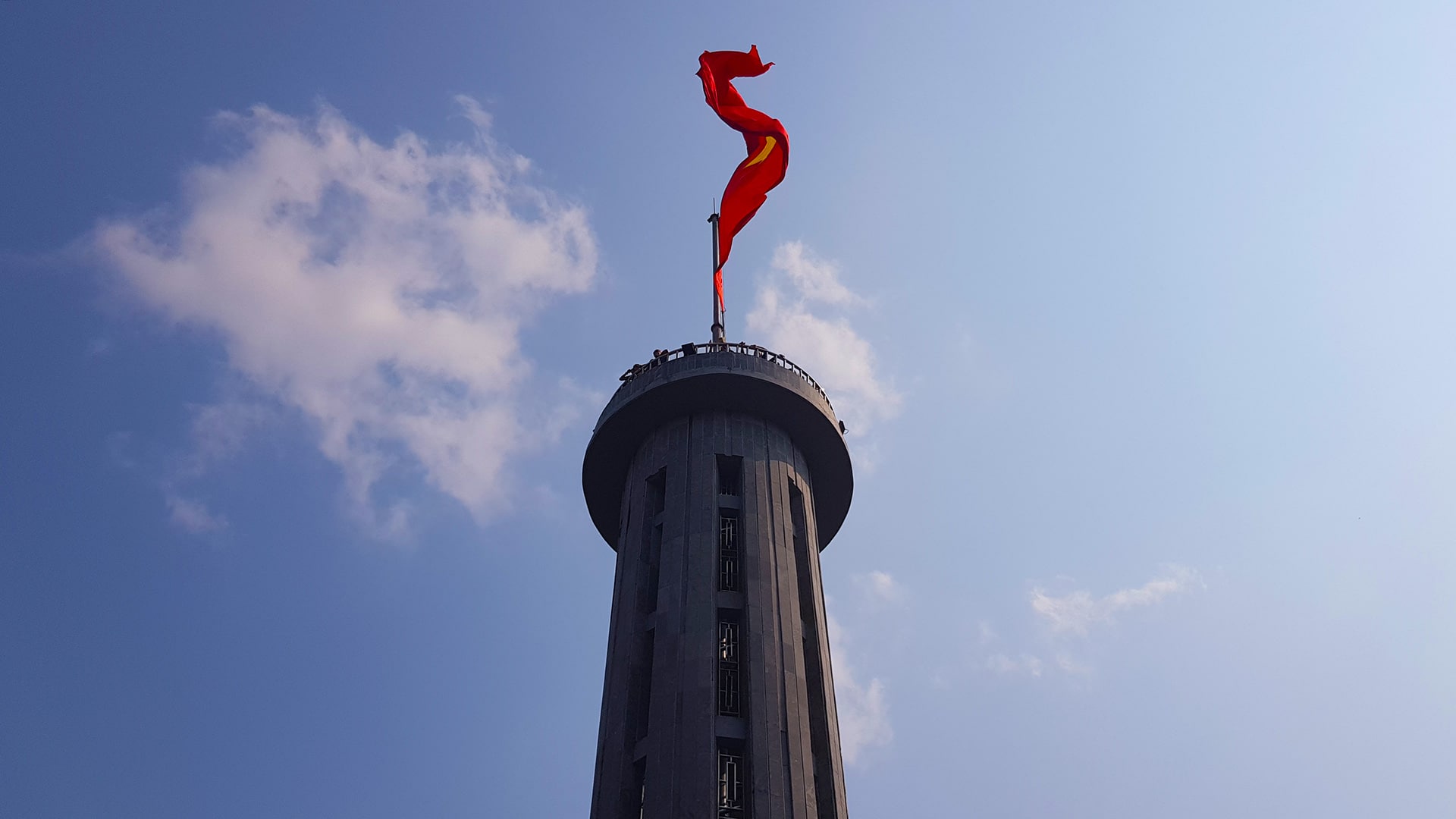
The journey from Yen Minh to Lung Cu takes you to the northernmost point of Vietnam. This route is a dramatic push through the heart of the Dong Van Karst Plateau, leaving the valley floor of Yen Minh for the high-altitude borderlands with China. It is a ride defined by sheer limestone cliffs, ancient Hmong villages, and the towering presence of the Lung Cu Flag Tower.
This route blog is part of our Ha Giang Route Planner, so if you are looking for further for ideas on routes and tips to help keep you safe. Check it out.
Quick Stats
- Region: North Ha Giang Loop
- Total Distance: Approx 70km.
- Duration: 1 Day / 4-5hrs driving time. But, you’ll stop a lot.
- Terrain: Steep, winding mountain passes, narrow border roads, and high-altitude plateaus.
- Best Time of Year: Nov-Dec: for dry skies and clear views.
- Best Time of Day: Good to get an early start here to beat the crowds. You might find it easier to get that Flag Tower selfie.
- Difficulty: Moderate to Challenging. While the roads are mostly paved, the narrow sections near the border and the steep final ascent to Lung Cu require focused riding.
- Fuel/4/5G: Plentiful until Lung Cu turn off. Be sure to fill. Intermittent 4G/5G coverage for most of the route.
- Warnings: Some of the roads to Lung CU are narrow and some are quite steep. This is not the place to learn to ride.
Route Map
Send to My Phone
The BLACK ROUTE follows the main road (4C) and is not a difficult drive other than the heavy traffic, especially on holidays. Once you turn off, it becomes more technical. It is NOT the place to learn to drive.
Where to Next?
Now that you are at the top tip of Vietnam, the only way to go is South. You are most likely to either go to Dong Van or at least pass through you on your way to either Du Gia or Meo Vac.
YouTube Video
Tips & Advice
There is a lot of climbing on this route which means a wide range of temperatures. Make sure to be prepared for this. The riding is a little challenging at times but traffic is low and the views are amazing.
Police & Law
- Alcohol: Strict zero-tolerance policy. Even one beer can lead to bike impoundment.
- Checkpoints: Possibly on the way out of Yen Minh. Road blocks are usually set up before here.
- Cameras: Speed/safety cameras are active in Yen Minh, not so much anywhere else until you get to Lung Cu.
Road & Safety
- Brakes: Use low gears(engine braking) on descents to prevent brake failure.
- Coasting: Never coast in neutral.
- The Route: There are narrow and steep parts on this route. Take care and stay in lane.
- Weather: Prepare for the cold and take rests to warm up if needed. Be comfortable with low visibility.
Clothing & Gear
- Layer for change: Wear layers that you can change easily.
- Waterproofs Be sure to have at least a raincoat. Even the constant mist will soak you to the skin.
- Hi-Viz Gear: Wear bright clothing or a high-vis vest to ensure you are seen through the mountain mist and heavy traffic.
Mountain Weather Realities
Conditions change rapidly as you climb. Expect high humidity and sudden dense fog or mist at the summits, which significantly reduces visibility.
Temperatures fluctuate quickly between the valleys and passes, and even light rain makes the oil-slicked asphalt extremely slippery. Always be prepared for low-visibility and high-moisture environments.
7-Day Due North Motorcycle Tour
Ride deep into Vietnam’s northern frontier: mountain passes, hidden valleys, and rich history packed into one unforgettable week Book NowFAQ
Is there a petrol station in Lung Cu?
There are no major “branded” petrol stations in Lung Cu village itself. Fill up in Yen Minh or Dong Van before you make the detour. Some small local shops sell petrol in bottles for emergencies, but it’s best not to rely on them.
Can I see China from the Flag Tower?
Yes! Looking north from the top of the Flag Tower, the valley below and the mountains immediately across the border are Chinese territory. You can often see the border fence winding through the hills.
Is it better to stay in Dong Van or Lung Cu?
Many riders stay in Dong Van for more food options. However, staying in Lo Lo Chai village (at the base of the Flag Tower) offers a much more authentic, quiet experience in traditional homestays.
We feel it depends on the season. Summer = Lung Cu; Winter = Dong Van. This is due to there being warmer hotels in Dong Van.
How many stairs are there to the top of the Flag Tower?
There are nearly 900 steps from the lower parking area to the very top. There is a buggy service that can take you halfway up if you are feeling tired from the ride.
Can I ride to the actual border fence?
While the road runs very close to the border, there are strictly marked “No Entry” zones and military posts. Stick to the main paved roads and do not attempt to cross any fences or unmarked trails near the border.
Entering the Stone Kingdom
The ride from Yen Minh to Lung Cu is a pilgrimage to the very top of the country. It is a journey through history, culture, and some of the most rugged terrain on earth. Standing under the massive flag at the summit, looking out over the border into China, is a moment of pure triumph for any Ha Giang traveler.
What’s Next?
If you are looking to wind your way through the small concrete paths that cling to the hillside, then you should follow our route map to Du Gia. If smooth sweeping tarmac and huge views are your thing, then head towards Dong Van, Meo Vac and then Bao Lac.
Adventure Awaits