Chưa có sản phẩm trong giỏ hàng.


The Pù Luông Nature Reserve is situated in the districts of Bá Thước and Quan Hóa, located in the northwest of Thanh Hóa province, Vietnam, approximately 130 km northwest of Thanh Hóa city.
Pù Luông Nature Reserve is 25 km away from Cúc Phương National Park, connected to the tail of Cúc Phương National Park by two parallel gray limestone mountain ranges. In between lies lush rice valley. To the north and northeast of the Pù Luông Reserve are Mai Châu, Tân Lạc, and Lạc Sơn in Hòa Bình province. Extending from the west to the south of the reserve is the Mã River, flowing from the border between Quan Hóa district and Mai Châu district (Hòa Bình province) through the Quan Hóa town area down to near Cành Nàng town (Bá Thước).
The primary forest in Pù Luông Nature Reserve is a type of seasonal tropical evergreen forest. Five subtypes of the main forest type exist due to the diversity of altitude and substrates: lowland limestone broad-leaved forest (60–700 m); lowland broad-leaved forest on shale, sandstone, and clay (60-1,000 m); limestone foothill broad-leaved forest (700–950 m); foothill needle-leaved forest on limestone (700–850 m); and Bazan foothill broad-leaved forest (1,000-1,650 m). The reserve also harbors secondary forest formations such as bamboo forest, shrubs, and agricultural land. Not far from Cúc Phương National Park, Pù Luông exhibits a high similarity in flora and fauna systems compared to Cúc Phương.
Two potential tourist sites are the Son Bá Mười area (Lũng Cao commune) and the peak of Pù Luông at 1,700 meters in the Thành Sơn commune.
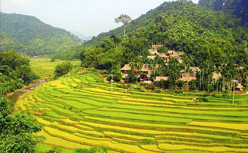
When is the best time to travel to Pu Luong?
As a highland area surrounded by pristine forests, the climate in Pu Luong is relatively pleasant, even during the hot summer days. Additionally, you may consider planning your exploration of Pu Luong during the following periods:
Late May to early June marks the beginning of the new rice season when the terraced fields and steppe paddies are adorned with lush greenery, creating a stunning and tranquil landscape.
September and October are ideal months as Pu Luong enters the ripe rice season. During this time, the terraced fields on the hillside transform into a vibrant golden hue, presenting Pu Luong with a rich and dreamy beauty.
Mid-summer is also a great time to visit Pu Luong since it is located in a low limestone mountain area, featuring dense tropical forests and sparse population. As a result, the air and weather in Pu Luong remain relatively cool amid the summer days.
Guide to Getting to Pu Luong
- Route 1: Exploration Enthusiast Route: Hanoi – Hoa Binh – Mai Chau – Pu Luong (~195km ~5 hours by car)
Mai Chau is a popular tourist destination near Pu Luong. If you want to explore both Mai Chau and Pu Luong, this is the only route to take. From Hanoi, travel on National Highway 6 through Hoa Binh for 145km to visit Ban Lac, Mai Chau, then continue about 50km to Pu Luong.
This route passes through the White Rock Pass, also known as Thung Khe Pass. It is exceptionally beautiful, traversing the Northwest cultural tourism route, Mai Chau – Ban Lac. However, it includes many winding and steep mountain passes, especially before entering the center of Pu Luong. Not suitable for the elderly or young children as it can be tiring and induces motion sickness.
- Route 2: Adventurous Souls Route: Hanoi – Thang Long Avenue to Hoa Binh – Muong Khen intersection – Cho Lo intersection – Lung Van – Pu Luong (~160km ~4 hours by car)
If you are an adventurous driver, the route from Hanoi – Thang Long Avenue to Hoa Binh – Muong Khen intersection – Cho Lo intersection – Lung Van – Pu Luong is sure to satisfy your adventurous spirit.
This is the shortest and most challenging route, passing through the Son-Ba-Muoi mountain pass. Along this route, you can admire towering and majestic mountain passes, experience strong sensations, and enjoy panoramic views of the Pu Luong valley. However, this route is quite steep and VERY dangerous, so travelers need to pay attention to ensure safety during the journey.
- Route 3: Search on Google Maps: Hanoi – Xuan Mai – Ho Chi Minh Road – Cẩm Thủy town – Cành Nàng town – Puluong Casa
The route from Hanoi – Xuan Mai – Ho Chi Minh Road – Cẩm Thủy district (Thanh Hoa) is about 145km. Then turn right to Cành Nàng town (Bá Thước district) 35km, and at the intersection of Cành Nàng town, go straight on Route 15C for an additional 20km to Pu Luong Casa in Nong Cong village (Thanh Son commune).
This is the most convenient route chosen by many travelers to reach Pu Luong. It’s an easy, straight road with few steep passes, beautiful landscapes, and wide views. The route passes through famous points of interest where you can explore places like Cuc Phuong Forest, Fairy Fish Stream in Cam Thuy, and Bamboo Rafting in Cham Stream.
What to Do When Visiting Pu Luong
Ban Kho Muong
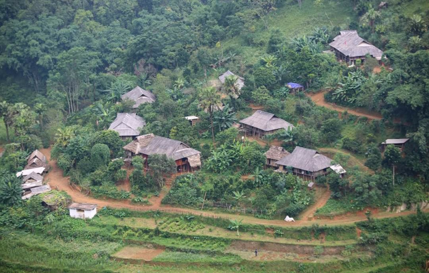
On the majestic journey to the summit of Pu Luong, there lies a pristine and rustic valley named Kho Muong. It is one of the most remote and challenging hamlets in Thanh Son commune, Ba Thuoc district, yet holds great potential for community-based tourism development due to its natural conditions and cultural traditions.
Kho Muong is nestled deep within the core of the Pu Luong Nature Reserve, less affected by human influence, maintaining its raw and picturesque features. Home to 60 Thai ethnic households with 230 inhabitants, Kho Muong stands apart from other hamlets in the region. The road to Kho Muong, about 2 km from the Thanh Son commune’s People’s Committee, is challenging, especially for adventure enthusiasts.
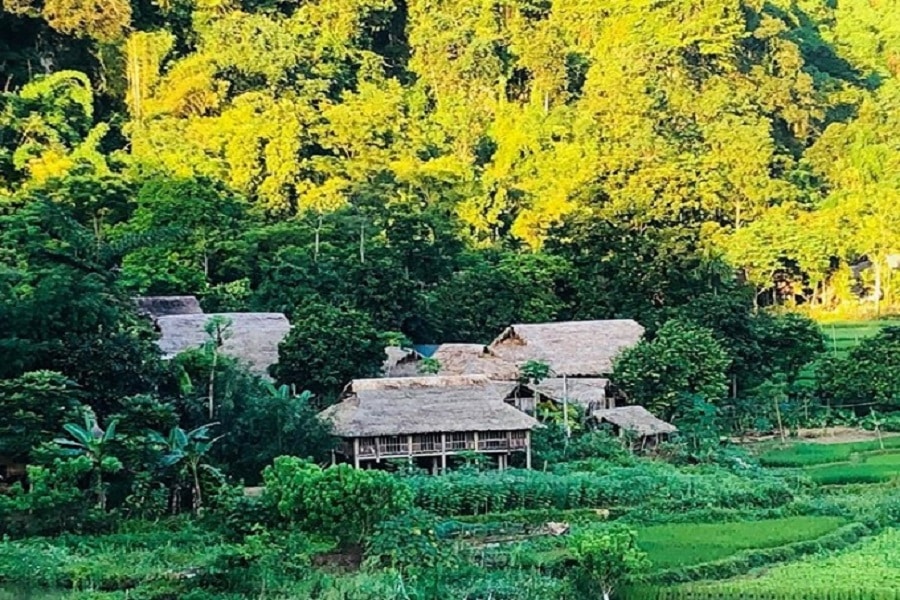
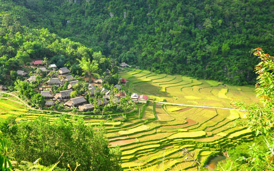
From a high vantage point, Kho Muong unfolds its captivating beauty, with stilt houses nestled at the foot of the mountain amid terraced fields of rice, corn, and cassava. The surrounding area is adorned with a myriad of green hues from the surrounding mountains. Residents primarily engage in cultivating rice, corn, and cassava for daily meals. Thanks to the generosity of nature, locals have built comfortable stilt houses to welcome tourists. Visitors to Kho Muong can enjoy the natural scenery, experience the cultural traditions of the Thai ethnic people, immerse themselves in the rustic life, and savor traditional mountain dishes like bamboo rice, forest banana blossom salad, bitter soup, corn wine, sour salted vegetable soup, and boiled duck meat.

Hang Kho Muong
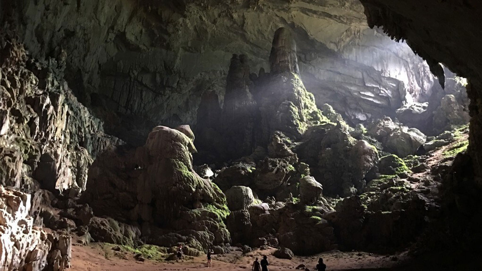
Hang Kho Muong is one of the captivating caves discovered within the Pu Luong Nature Reserve. Formed around 250 million years ago, its limestone formations extend approximately 2.5 km northward, connecting Kho Muong to the Pong village in Lung Cao commune. The underground river system within the cave is a common feature of Kart limestone areas, linking valleys through flowing streams. Hang Kho Muong is also a habitat for various bat species, with at least four different species residing at different times of the year. Venturing deeper into the cave, visitors can marvel at unique rock formations resembling humans, trees, animals, with diverse colors, creating a vibrant and distinctive display. A spacious open area deep within the cave looks like a natural volleyball court, adding to the cave’s uniqueness.
Ban Don (Thanh Lam Commune)
Ban Don is mainly inhabited by the Thai ethnic group, with 285 residents (80 households). In recent years, more domestic and international tourists have visited Ban Don, attracted by its tranquil space and pristine natural landscapes. Visitors can also enjoy local specialties such as forest bamboo shoots, wild duck, wild pig, hillside chicken, pumpkin leaves, and chayote, all served with the sincere hospitality of the local people.
Ban Son Ba Muoi
Son Ba Muoi comprises three highland hamlets in Lung Cao commune. Located approximately 130 km northwest of the city center, it is considered a miniature Sapa due to its temperate climate throughout the year. Son Ba Muoi is unique and isolated, preserving many ancient Thai customs, with traditional stilt houses unaffected by modern architecture
