
Routes
Ha Giang to Du Gia: The Emerald Valley
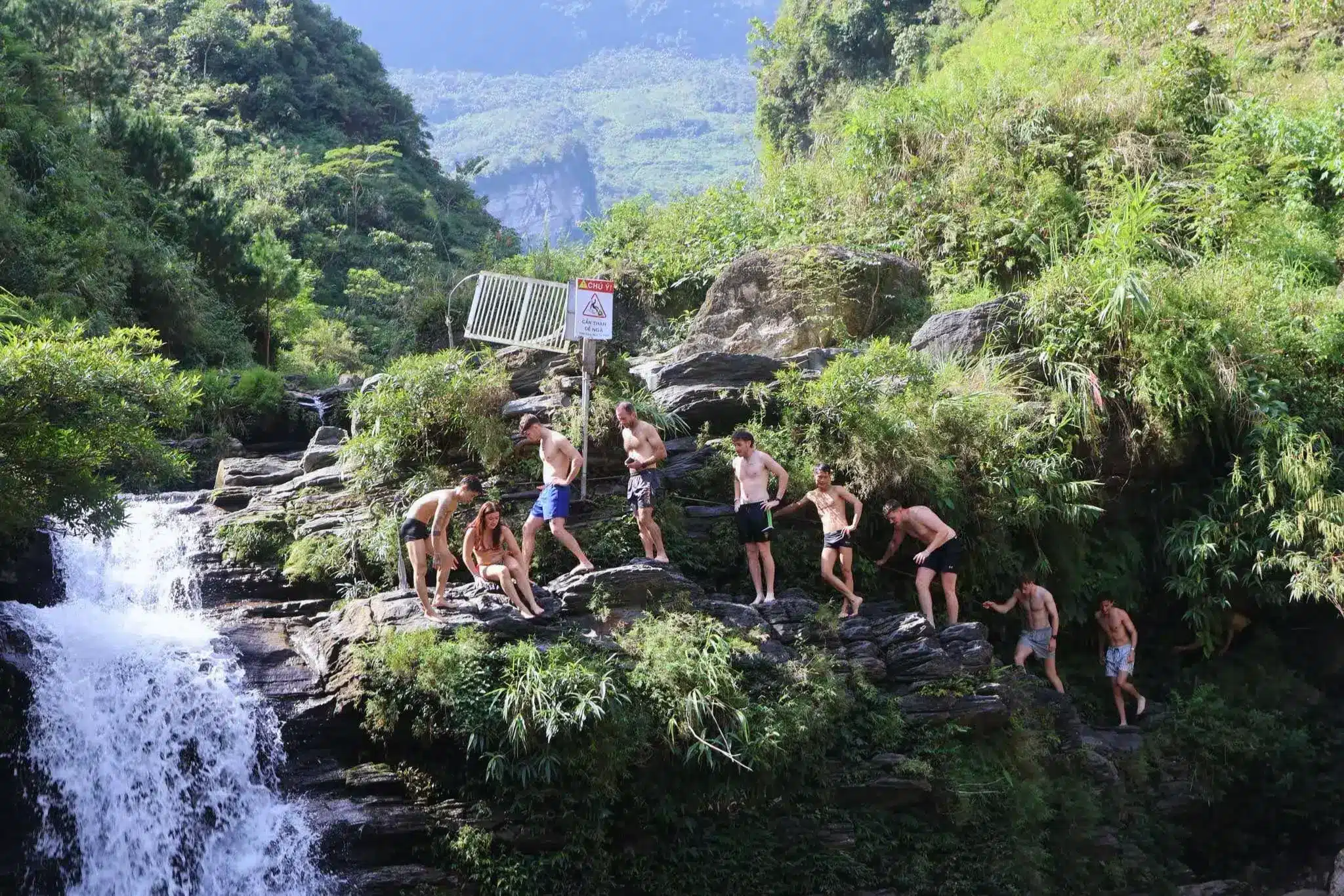
Branching off the main highway (QL34) toward the remote village of Du Gia, this route transitions from wide riverside pavement to narrow, winding mountain tracks. It is widely considered one of the most scenic stretches of the Ha Giang Loop, taking you through deep canyons and high-altitude limestone “forests.”
This route blog is part of our Ha Giang Loop Planner, so if you are looking for further for ideas on routes and tips to help keep you safe. Check it out.
Quick Stats
- Region: Ha Giang Highlands
- Total Distance: Approx 80km
- Duration: 1 Day / 4-5hrs driving time.
- Terrain: Mixed. Smooth highway on QL34. Steep sometimes broken asphalt towards Du Gia.
- Best Time of Year: Nov-Dec: for dry skies and clear views.
- Best Time of Day: 10am to 3pm due to dense fog that might occur. Tourists are not common.
- Difficulty: Moderate. Especially, when wet due to roadworks. Steep descents into Du Gia
- Fuel/4/5G: Scarce fuel stops. Intermittent 4G/5G coverage for most of the route.
- Warnings: QL34 has large trucks, be wary on corners.
Route Map
Send to My Phone
The BLACK ROUTE will take you on the QL34, which is busy with heavy traffic. Then, you turn North onto the smaller road which is now rebuilt but still has steep inclines and the occasional area of broken tarmac, before the steep descents into Du Gia Village.
Where to Next?
Now, you are in Du Gia and as much as you might want to stay here, there are plenty of other places to explore in and around ‘The Loop’.
The obvious choices are: Yen Minh [future link], Meo Vac and Dong Van [future link]. Take a look and see what you fancy.
YouTube Video
Tips & Advice
Driving in Vietnam is not for the faint-hearted and there is a steep learning curve. As such, here are a few tips that will help speed up your transition to vietnam road demon. Good luck.
Police & Law
- Alcohol: Strict zero-tolerance policy. Even one beer can lead to bike impoundment.
- Checkpoints: Frequent in Dong Van, but rare on route to Lung Cu. Still have your 1968 IDP and home license ready.
- Cameras: Speed/safety cameras are active all along the route, especially in villages.
Road & Safety
- Brakes: Use low gears(engine braking) on descents to prevent brake failure.
- Coasting: Never coast in neutral.
- The Route: There are narrow and steep parts on this route. Take care and stay in lane.
- Inexperienced Drivers: Look out and drive defensively. Leave the EGO in the hotel.
Clothing & Gear
- Layer for change: Wear layers to keep you covered from the Sun and warm in the mountains. Conditions change rapidly.
- Prioritize Grip & Protection: Use sturdy, over-the-ankle boots and ventilated motorcycle gloves; flip-flops offer no traction or protection against engine heat.
- Hi-Viz Gear: Wear bright clothing or a high-vis vest to ensure you are seen through the mountain mist and heavy traffic.
- Wrap Up: Prepare for the cold as you are quite far North. Homestays will have limited heating, too.
Mountain Weather Realities
Conditions change rapidly as you climb. Expect high humidity and sudden dense fog or mist at the summits, which significantly reduces visibility.
Temperatures fluctuate quickly between the valleys and passes, and even light rain makes the oil-slicked asphalt extremely slippery. Always be prepared for low-visibility and high-moisture environments.
7-Day Due North Motorcycle Tour
Ride deep into Vietnam’s northern frontier: mountain passes, hidden valleys, and rich history packed into one unforgettable week Book NowFAQ
Is there petrol available between QL34 and Du Gia?
Petrol stations are frequent along the main QL34 highway. However, once you turn off toward Du Gia, formal stations disappear. It is highly recommended to fill your tank completely at the junction before heading into the mountains. In an emergency, small local shops in villages may sell petrol by the bottle (often 1.5L), but these are more expensive and lower quality.
Are there police checkpoints on the way to Du Gia?
While major checkpoints are usually located in towns like Yen Minh or Meo Vac, mobile police patrols occasionally operate near the QL34 junction. Ensure you have your International Driving Permit (1968 Convention) and a valid home license. If you are riding without a legal license, your insurance will be voided, and you risk a fine or bike impoundment.
Can I visit the Du Gia waterfall year-round?
Yes, but the experience changes. The best time for swimming is the dry season (March to May and September to November), when the water is clear and the pools are accessible. During the peak rainy season (July-August), the waterfall is a powerful, muddy torrent and the rocks become dangerously slippery, making swimming unsafe.
Is it safe to ride this route during the rainy season?
This is one of the higher-risk areas during heavy rain. The steep slopes are prone to small landslides and falling rocks, and the “M” Road hairpins become incredibly slick due to runoff. If it is raining heavily, it is often wiser to wait a few hours in a local café on QL34 until the weather clears.
What kind of bike is best for the QL34 to Du Gia stretch?
A semi-automatic (110cc+) or a manual bike (150cc) is highly recommended. Fully automatic scooters can struggle with the steep climbs and, more importantly, lack the “engine braking” needed for the long, steep descent into the Du Gia valley, which can lead to brake overheating and failure.
The Heart of the Loop
Descending into the emerald valley of Du Gia is the ultimate reward for navigating the rugged, high-altitude passes of the southern loop. While the road demands your full focus and respect, the village’s serene rice terraces and hidden waterfalls offer a peaceful sanctuary.
It remains the most authentic, off-the-beaten-path highlight for any rider seeking the “Real” Ha Giang.