
Routes
Cao Bang to Ban Gioc: The Waterfall Run
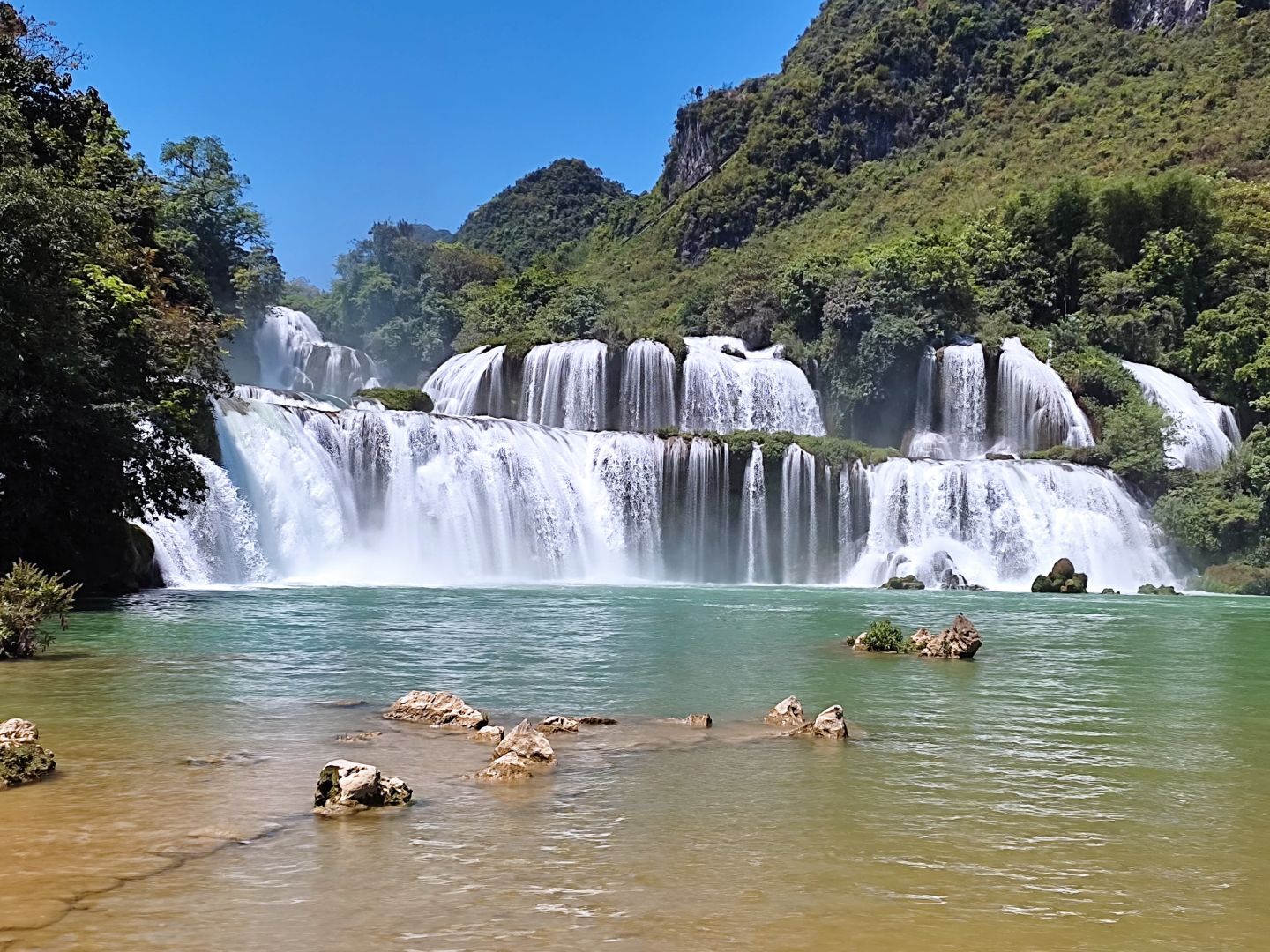
If you thought Ha Giang was the peak of the North, Cao Bang is here to change your mind. This UNESCO Global Geopark looks like a prehistoric painting; thousands of limestone peaks divided by turquoise rivers.
The best part? The road to Ban Gioc Waterfall is pure riding bliss: smooth, “black velvet” tarmac and cinematic hairpins like Ma Phuc Pass.
Beyond the falls, the culture runs deep. Don’t miss the Dia Tren paper-making village, where ancient techniques turn bark into art, or the haunting, cathedral-like depths of Ha Lang Cave. Grab your gear; the mist is calling.
Quick Stats & Navigator
- Region: Northeast
- Distance: ~90km
- Time: 3–4 hours
- Difficulty: 3/10 – Smooth tarmac with predictable hairpins.
- Road Surface: 100% Asphalt. Fast, grippy, and generally well-maintained.
- Best time of year: Sep / Oct to catch the ‘Golden Rice Paddy’
- Best time of day: 7:30am to beat the heat and tour buses.
- Fuel/4/5G: Fuel stations are frequent until you get close (10km) near the falls. Connectivity is very good.
- Warnings: Can be heavy vehicles on the section to Ma Phuc Pass.
Route Map
Send to My Phone
Route 1 (black): The Mainline
Route 2 (red): The Ha Lang Backroute
The Route
Why ride the same road twice? Most travelers make the mistake of a quick out-and-back dash, but the real magic of this region lies in the 2-Day Loop.
By taking Route 1 (Through Trung Khanh) for your our and Route 2 (The Ha Lang Cave route) for your return, you turn a simple commute into a 48-hour deep dive.
Spend your first day exploring the craft villages and beautiful valleys following the Quay Son River and reaching the falls by sunset.
Stay overnight in a traditional Nung stone homestay, and then on Day 2 visit Nguom Ngao cave and take the border route through Ha Lang cave and the small villages along the valley floor back to the Ma Phuc Pass and then Cao Bang city in time for the night bus home.
Your biggest decisions then become which of the stunning sights do you spend most time at 🙂
Route 1 (Red)
Exit Cao Bang City via the Bang Giang Bridge. Follow the QL3 East. You’ll hit the Ma Phuc Pass almost immediately. The view from the 7th tier is worth stopping for. Once over the top, stay right at the fork toward Trung Khanh. Only turn left if you plan to make a visit to Angel Eye Mountain. You will pass the Paper Village and Blacksmith’s Village and then reach Quang Uyen. Both Quang Uyen and Trung Khanh are good stops for refreshments and refuelling, if you need. After Trung Khanh, take the DT206 East to Dam Thuy and the Ban Gioc Waterfall.
Stops on Route
You will want to stop at the Ma Phuc Summit. There’s a small pull-off where the “UNESCO Geopark” sign sits. The view back down the valley is your first “big mountain” moment. You can arrange your stops by town. First stopping in Quang Uyen and also Trung Khanh. Both are major towns and good places to take a break. You will find many local delicacies in the market depending on the time of year.
Route 2 (Black)
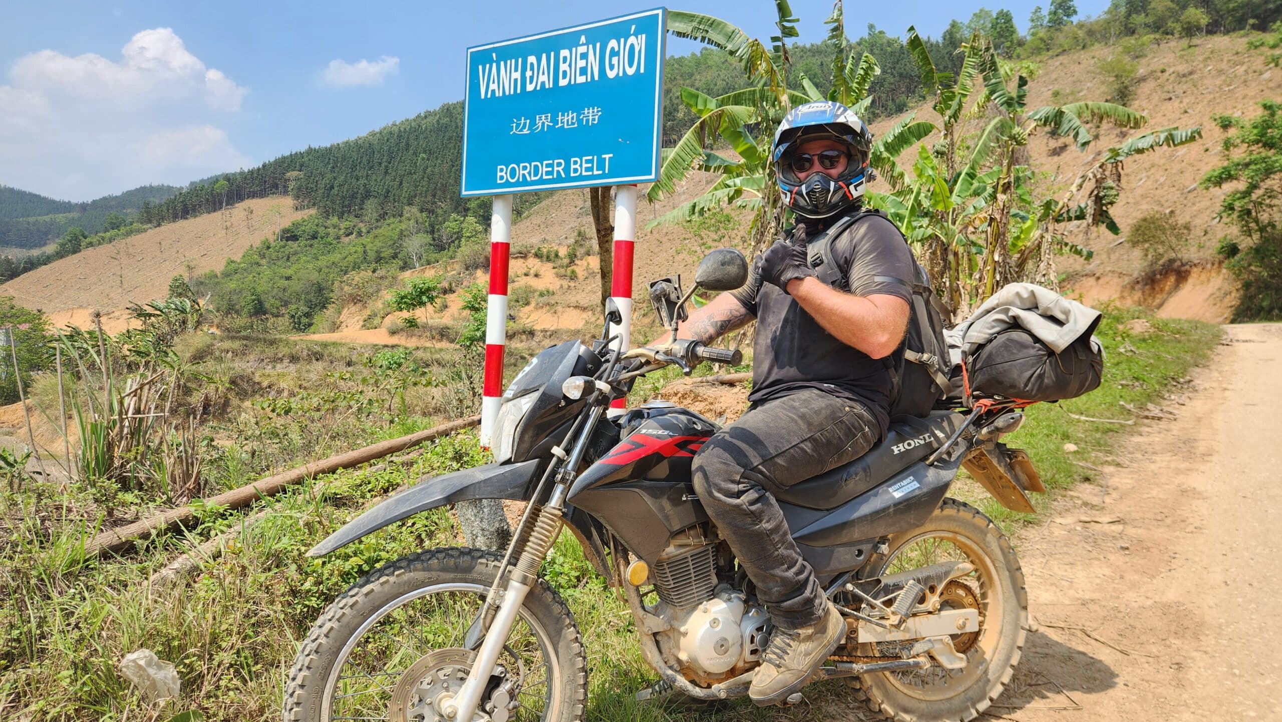
Follow Route 1 until you get to Quang Uyen. Then, about 2km North turn right onto the DT207 and head towards Ha Lang Cave. This is slower, quieter, and takes you past ancient stone-stilt houses, locals doing laundry in the river and the Vinh Quy Burnt Hills. Then, follow the Quay Son river to approach the falls from the South. Don’t forget to stop at the border posts for a quick selfie.
Stops on Route
To begin you can stop at Ma Phuc Pass and then at the paper village and blacksmith’s village, if you have time. There is also Vinh Quy burnt hills and Ha Lang cave to enjoy. One of the highlights on this route is the border fence between Vietnam and China that you can see on the approach to the falls.
Choose your Steed
The road to the falls is a mix of high-speed sweepers and tight village tracks, so your choice of bike completely changes the flavor of the ride. Whether you want to “point and shoot” on a big engine or nimble your way through the back-alleys, here is how the fleet handles the run to Ban Gioc:
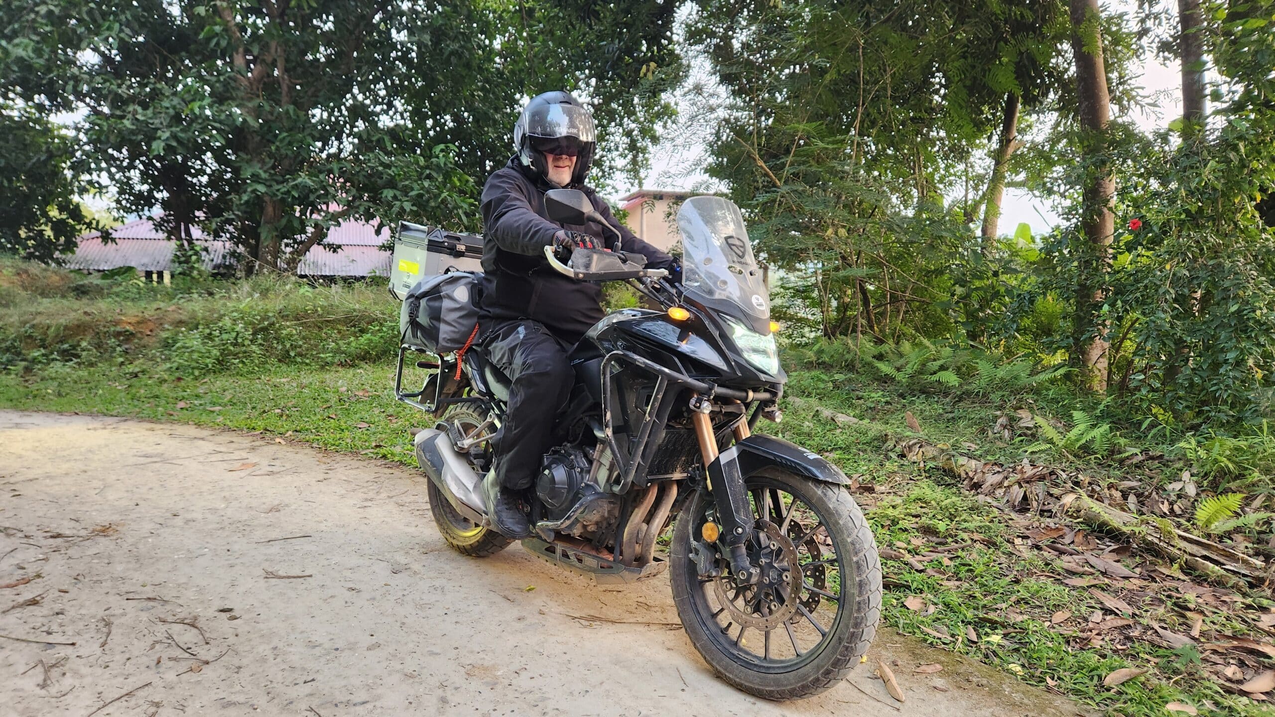
CB500x
This is “Big Bike” territory. The sweeping turns of the Ma Phuc Pass were built for the 500X. You’ll have the power to overtake slow-moving trucks with ease on the climbs. The extra power and comfort is welcome on the smooth tarmac roads both from Hanoi and within Cao Bang province itself. If you are planning a longer tour or are taking a pillion passenger, then the CB500x is a great choice of rental.
The XR150/190L
While the roads are mainly paved, the XR150 shines when you decide to duck off the main road into the narrow, concrete lanes of the Nung villages or the muddy banks of the Quay Son River.
It is possible to take a pillion on this and the XR190 but it can be cramped and the suspension may not be too happy about it. However, they are a great choice that enables you to see all of the available areas and not be concerned that you get stuck in the mud as she is light enough to pick up and spin round.
The Semi-Auto (Blade / Future)
The local hero. You’ll be shifting gears constantly on the passes, but you’ll have the best fuel economy in the province. Just watch your brakes on the long descent into the Quang Uyen valley.
These bikes are not so comfortable for one or long days in the saddle but they can do the job and if you are on a budget they work just fine. We prefer the the Honda Future 125cc over the Blade as it is a more powerful engine and better brakes. This means it is safe if you have a pillion, but both will do the job.
Try not to overload them with gear, leave it in Cao Bang, and think carefully before deciding to take a pillion. Notice none of our Easy Riders use these for pillion tours.
Honda CB 500X Motorcycle Rental
Engineered to handle whatever the road throws at you Book NowWhere to Go Next?
Now that you’ve reached the falls, where does the compass point?
[Ban Gioc to Pac Bo] (The Revolutionary Road)
This 120km route takes you from the edge of the border to the “cradle of the revolution.” The cave hideout, Pac Bo where Uncle Ho masterminded his return to Vietam. You’ll ride through the heart of Cao Bang’s karst landscape, passing through Tra Linh and ‘interesting’ buffalo market. The road is well-paved but winds through high mountain ridges, offering sweeping views of the limestone valleys below.
[Ban Gioc to Bao Lac via the Border Road]
This is the “Black Belt” of Northeast Vietnam riding, reserved for those who prefer silence over tourist stops. Covering roughly 200km, this route tracks the winding border fence through raw, jagged limestone karsts. It’s a demanding, full-day push that has you navigate the Na Tenh and Khau Coc Tra Passes, but rewards you with the grit of the frontier and a sunset arrival into the deep valley of Bao Lac.
FAQ
Is it safe to leave my bike and gear at the waterfall while I explore?
Generally, yes. Ban Gioc has a dedicated, paid parking area (usually 10k–20k VND). It’s very safe, but we always recommend taking your helmet and expensive tech (cameras/drones) with you. Leave the heavy luggage strapped tight—local opportunistic theft is rare here.
Do I need a special permit to ride so close to the Chinese border?
Currently, for the main run to Ban Gioc and the cave, you do not need a special frontier permit (unlike parts of Ha Giang). You only need your standard entry ticket for the falls. However, always carry your passport and a valid International Driving Permit (IDP) just in case of a routine check.
What is the “Golden Rule” for overtaking trucks on mountain passes?
Don’t trust the indicators. In Vietnam, a truck flashing left often means “don’t pass me, it’s not safe,” rather than “I am turning left.” Some truck drivers will indicate right to signal that the road is clear. Double check this and never ‘trust’ them. Wait for a clear line of sight, give a short tap on your horn to let them know you’re there, and pass with conviction.
Is there 24-hour fuel available in the Cao Bang province?
Not really. Most petrol stations in the smaller towns (Quang Uyen, Trung Khanh) close by 7:00 PM or 8:00 PM. If you’re planning a sunset ride back to the city, make sure you top up your tank before the sun goes down.
Is the road to Ban Gioc suitable for a pillion (passenger)?
Absolutely. Because the routes are so well-paved, this is one of the best routes in the North for two-up riding. If you’re carrying a passenger and luggage, we highly recommend the CB500X for the extra torque on the climbs.
The CB loves Cao Bang’s long, straight and smooth roads, but so do the cops so watch out for speeding.
The Final Turn
By the time you see the spray rising over the Quay Son River, the 90km behind you will have already changed your perspective on Northern Vietnam. Ban Gioc is the main attraction that brings people here, but the real Cao Bang is the smooth tarmac roads and the small artisan villages of the province.
Ready for the next leg? The adventure doesn’t stop at the water’s edge. Instead of heading back to Cao Bang City, why not extend your trip and seek out Bao Lac. It’s an amazing drive along the border with China and well worth the extra days.